Les Bons (Les Bons)
Les Bons is a village in Andorra, located in the parish of Encamp.
Map - Les Bons (Les Bons)
Map


Country - Andorra
 |
 |
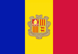
| Flag of Andorra | |
Andorra is the sixth-smallest state in Europe, with an area of 468 km2 and a population of approximately. The Andorran people are a Romance ethnic group of originally Catalonian descent. Andorra is the world's 16th-smallest country by land and 11th-smallest by population. Its capital, Andorra la Vella, is the highest capital city in Europe, at an elevation of 1023 m above sea level. The official language is Catalan, but Spanish, Portuguese, and French are also commonly spoken.
Currency / Language
| ISO | Currency | Symbol | Significant figures |
|---|---|---|---|
| EUR | Euro | € | 2 |
| ISO | Language |
|---|---|
| CA | Catalan language |